

Driving in Malaysia is, let’s say, an experience. As with everything, it always helps to be prepared – and so rather than lose valuable time getting used to the layout of the roads in the county, here are two handy interactive maps that show you all the major highways in Malaysia. Happy driving!
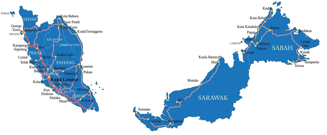
West / Peninsular Malaysia
Highways connect most of the major city destinations in all corners of peninsular Malaysia. Perlis and Butterworth in the northwest, Kelentan and Terangganu in the northeast, Kuanatan in the mid-east and Johor in the south are all connected to the capital Kuala Lumpur in the central west.
[wpdatatable id=3]
East Malaysia
In Malaysian Borneo, one major highway runs all the way from the Semantan in the west, via Kuching, Sarikei, Bintulu and Miri into Brunei. It then continues to Jalan Datuk Peter Mountain towards Sandakan in the east and loops back on itself via Lahad Datu and Tawau in the southeast corner of Sabah, near the border with Indonesia.
ExpatGo Guide to Driving in Malaysia – Index