Google Maps is by far the most famous map application on the planet. However, Google decided to improve it, and unveiled the new map service at the Google I/O conference this year.
The new map service aims to further personalizes information to users. Furthermore, Google Street View, Google Earth and the original Google Maps features have all been rolled into this new Google Maps application.
The new Google Maps has not been released to the public yet. It’s only available to some of the people who requested invites. Here in Malaysia, we requested an invite, and we’re been granted access to preview it. It seems that in Malaysia we’ll have the same access to Google Map features as the States. Here’s our takeaways.
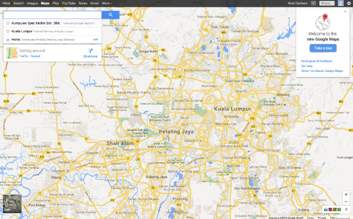
Google Maps Stunning New Look
The new Google maps has a refreshingly clean, new look to it. The navigation sidebar has been removed and the map occupies the whole screen now. The search bar is now at the top left corner and the last three searches are shown once you start typing in the search bar. In fact, the map application looks very similar to the mobile version. Google Maps now puts more emphasis on results being relevant to users and once you type in a search term like “Chinese restaurants”, it shows results that are either close to your current location or ones recommended by friends.
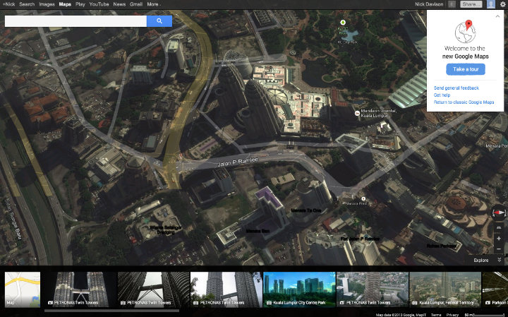
Google Earth and 3-D View
You can click on the satellite icon in the bottom left corner to access the Google Earth view of the map. Additionally, most of the places can be seen via Street View. The 3-D view via Google Earth is just okay; some of the buildings have a nice virtual shape but most remain flat. It does have a Sim City kind of feel to it.
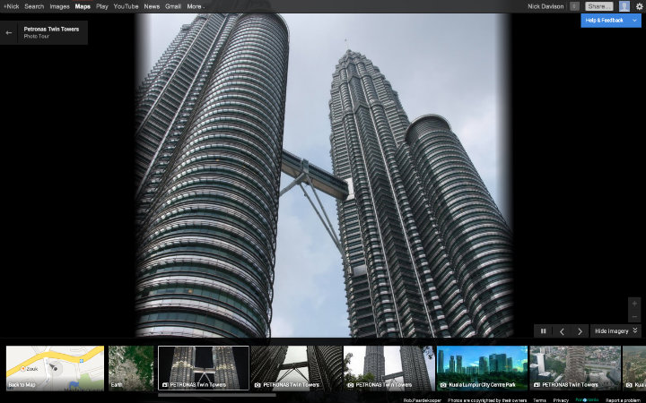
Google Maps Photo Carousel
Additionally, a photo carousel is present at the bottom of the screen, which is way to great give you visual feel of the location you’re checking out. What makes it even more fascinating is that the focus on the images continuously zooms and rotates to different angles, giving you as if you’re flying around the location and seeing the subject from different angles (or the different angles in which users’ photos were taken of the object).
Another neat feature when viewing the map is when you hover your mouse over a thumbnail photo in the carousel, a line will automatically connect to the point on the map representing the photo.
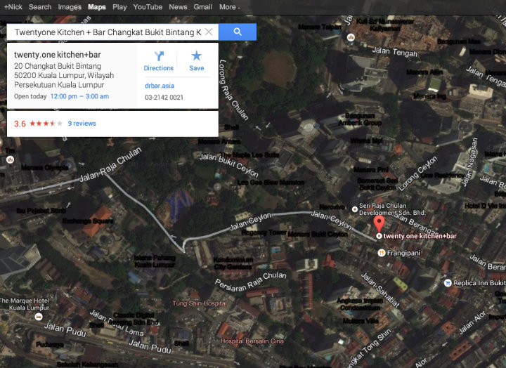
Google Maps Loaded with Information
Google has made it easier for users to use the map application. Once you click on a location, an Info Card of the place is displayed below the search bar right on the map. Address, directions, working hours, recommendations, ratings and other related information can be found in this Info Card. You can even filter your searches based on various factors like landmarks, friends’ recommendations, etc. to get the best results.
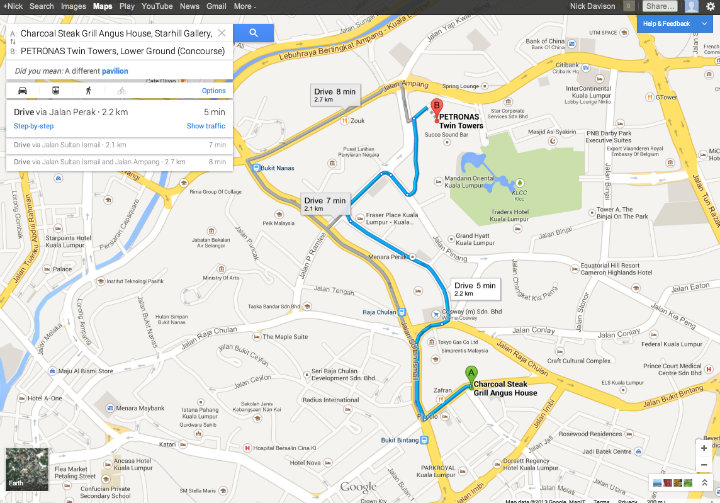
Google Maps Intuitive and Informative Directions
One of the best features of the new Google Maps is that it learns your preferences the more you use it. As you save locations, rate places, leave recommendations, look for directions, etc. the map application remembers your interactions so that future map results are tailored to your tastes and needs. The application also offers suggestions or recommendations based on previous interactions with it.
Obviously, one of the biggest reasons people use Google maps is for directions. And this features appears to remain strong in the new Google Maps. Once you have selected a place on the map, you can easily find directions to that place by clicking on the “Directions” button in the info card. The best route is shown by default but you can get alternatives routes and routes based on different transportation means, such as walking, cycling or taking public transport.
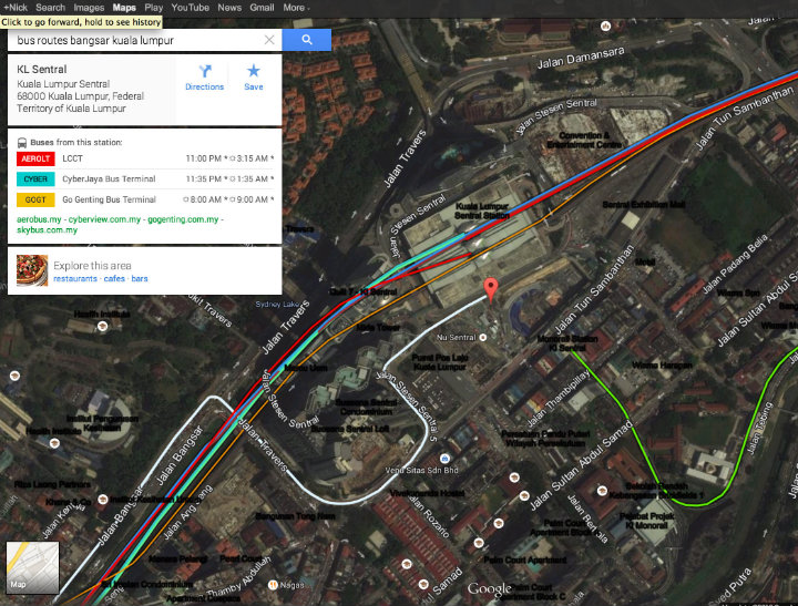
Google Maps Transit Information
Google launched the traffic and transit feature on the old Google Maps in Malaysia back in 2009. The new Google Maps also shows bus routes and timings and the number of buses you need to take to get to a new location.
What do you think about the new Google Maps? Share a thought in the comments below. Also, stay in touch with us by registering for our free e-newsletter here.
Photo Credit: Google Maps
"ExpatGo welcomes and encourages comments, input, and divergent opinions. However, we kindly request that you use suitable language in your comments, and refrain from any sort of personal attack, hate speech, or disparaging rhetoric. Comments not in line with this are subject to removal from the site. "