

Few travel experiences can inspire quite as much awe as hiking to the top of a mountain, but as James Springer found during his time in the Philippines, that feeling of wonder and respect is only amplified when the mountain in question is a volcano with a rather tempestuous history.
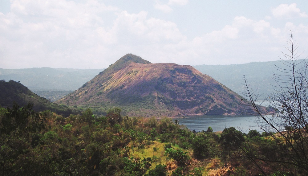
After picking our way through the debris of a resort undergoing a major restoration, we found ourselves sitting in a twin-engine boat gently bobbing on the edge of Lake Taal, just alongside the shoreline skirting the town of Tagaytay in the province of Talisay. Across the lake to the south spreads Taal Volcano Island, a flat and somewhat unimpressive landmass that certainly did not inspire visions of any great volcano.
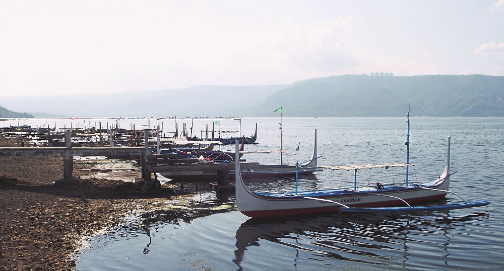
The engines roared, pointing us in the direction of the island, and with Filipino pop blasting from the boat’s speakers, we were on our way. The journey was dreary. In fact, while on the lake, it seemed like the scale of the fabled Taal Lake – a double caldera of a volcano, within a lake, within a volcano again – had been somewhat clipped.
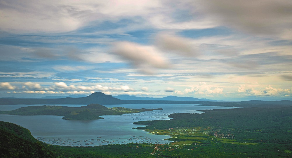
It was in Tagaytay, the day before, that we had our first glimpse of the renowned Taal Volcano natural megastructure, a complex volcano that, from the right vantage point, affords one of the most picturesque panoramic views in the Philippines. And indeed, looking out over the view from the so-called Palace in the Sky, it was clear why Imelda Marcos picked Mount Gonzales as the site for her exclusive retreat.
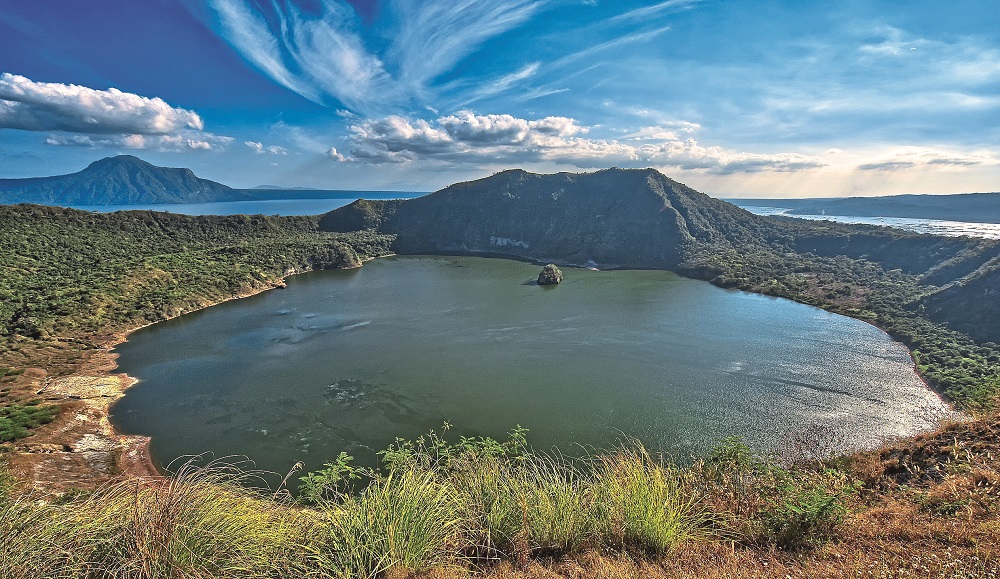
To the south stretches – left and right in a massive, kilometrewide circular rim – the circumference of the Main Crater Lake, a caldera resulting from an emptied magma chamber collapsing far below. And in the middle of the main lake, draped in a pale blue mist, rests Volcano Island, somehow seeming dwarfed and impotent. The palace was abandoned mid-way through its construction and now exists as little more than a monument to public funds being misused by corrupt leaders.
Standing as a skeletal concrete frame, the inside of the palace has collected a thick, green layer of mould which has been scraped away by innumerable visitors, now bearing white-etched proclamations of love. If there is anything standing as a testament to the immortality of Taal Volcano, it is that palace: an edifice that seems to define the fleeting nature of human existence in comparison to the near-timeless scars left on the earth’s surface during its geological history.
So it was worth venturing up Mount Gonzales just to put the whole thing into perspective. But, while on the boat, skimming across the main lake’s smooth surface, that sense of awe seemed muted. In fact, we were completely oblivious to what would soon become a remarkable and treasured experience.
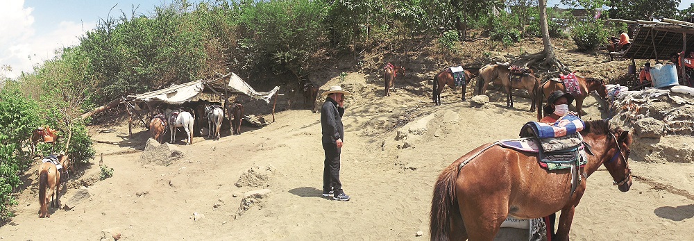
Docking at the island revealed a village style of life and a surprising commodity supporting business based on the tourism the volcano naturally attracts: horses. Around every corner, tethered to every tree and munching on every tuft of grass were slight ponies that looked more like donkeys in build. Their ostensible purpose was as surprising as their presence: to ferry either overweight or hiking-averse tourists to the top, a feat which seemed impossible when considering the horses’ hip bones jutted out like mountain bluffs.
Moreover, a Himalayan-ridge of a spine made a very uncomfortable-looking saddle. Needless to say, we hiked up, a decision we fully appreciated about halfway to the top, as riders who passed us with gritted teeth and pained expressions looked to be in quite a state of discomfort.
Heading up the mountain
The hike itself was a novel experience.
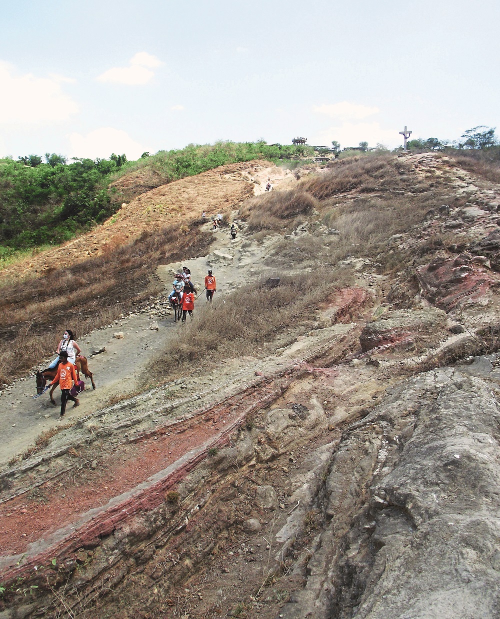
After a relatively flat start out of the village, the path began to incline gradually, but what really made the going tough was the fine layer of volcanic dust carpeting the whole trail.
As well as creating a bit of a sliding effect as we walked through the mini-ravines carved out to make the path, the dust was so fine that the hikers and horses kicked it up into dust pockets, a cloud so thick at times, we had to cover our faces in a desperate effort to avoid inhaling it.
Halfway up, the path opened, revealing a patchwork of deep green palm orchards intermingled with barren patches of burnt trees and black earth along the side of the volcano.
It was at that midway point that we began to feel a sense of what it would be like at the top.
Just below the sharp summit, we encountered a treacherous incline, the path once again morphing into mini-ravines so that the band of colourfully dressed hikers in front of us suddenly disappeared only to emerge again at the top.
Once through this part, the only other obstacle was a holding area for the horses, little more than a collection of rickety lean-tos to protect the horses from the blazing sun, and other shelters at which the horse guides could rest while their plump passengers made their final push to the top by foot.
Reflection at the summit
When we reached the top and looked down at the algae-green lake at the bottom of the crater, as well as soaking in the panoramic view at eye level, two things came to my mind that could only have been appreciated there. The first was that when I looked down at the crater lake and caught a glimpse of bubbles coming to the surface from the depths below, Taal Volcano no longer seemed benign.
It was there that the volcano really impressed on me its menacing character, the very crater itself a testament to the awful power which rests beneath it. Even though its most active history was from 1965 to 1977 – erupting during that time nearly every year – it was the legendary eruption of 1911 that seemed all too real as we stood on the precipice of the crater’s rim.
On a Sunday afternoon in late January 1911, the volcano began emitting jets of steam, and a number of earthquakes rocked the region. Then, during a four-hour period, the volcano erupted and exploded, ejecting fiery rocks and ash which coated the towns of Talisay, San Nicholas, and Baňadero. At its most violent stage, in the early morning of January 28th, the eruption was felt as far away as Manila and Dagupan, waking people by what was called “a strong earthquake and very large booming sound.”
The unassuming, flat landmass I had viewed on the boat ride over suddenly became something else entirely when seen from its crater rim: a sharp reminder that those in the past, living in the shadow of nature’s most fearsome spectacle, paid dearly for this proximity. More than 1,300 people died as a result of the 1911 eruption – perhaps many more.
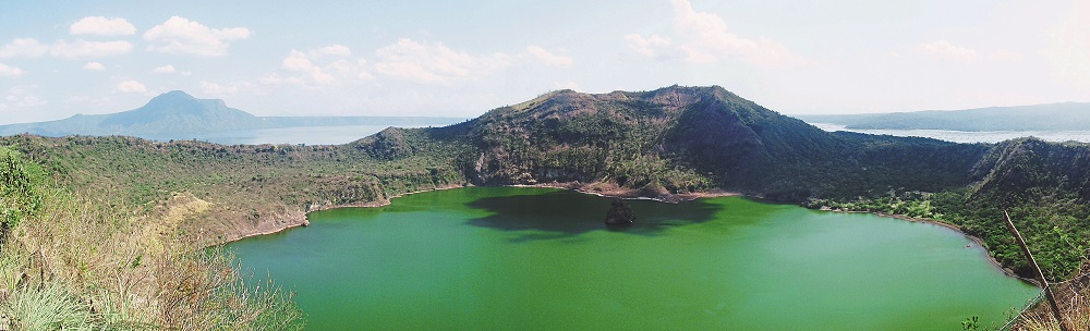
The second thing I felt was a true sense of scale, something which could only be experienced at the top.When rotating on the spot, panning 360 degrees, the whole formation – from the main crater lake to the crater and lake on Volcano Island – became a mind-bending fractal that reminded me of a Russian doll: one inside another, inside another again.
Apart from viewing it from above, the view from the top of Taal Island’s crater is the only place that presents the whole thing in its entirety – and it is truly an awesome sight to see. Perhaps the most enlightening effect for me was a sense that, considering this huge formation is on just one island of the more than 7,000 in the Philippines, made me feel incredibly small; all but insignificant in the presence of such stubborn grandeur.
After a leisurely rest (while trying to avoid a persistent old woman trying to sell the opportunity to drive a golf ball into the crater for a mere 50 pesos a swing), it was agreed to head back. The hike down, of course, is nearly always quicker and easier, and our group – far from being tired – felt revitalised from our time atop the volcano.We stopped for a beer and then continued on with another enjoyable group of young local students, each as giddy as we were. It is – as they say – more fun in the Philippines
"ExpatGo welcomes and encourages comments, input, and divergent opinions. However, we kindly request that you use suitable language in your comments, and refrain from any sort of personal attack, hate speech, or disparaging rhetoric. Comments not in line with this are subject to removal from the site. "


David Milly Gatehouse