


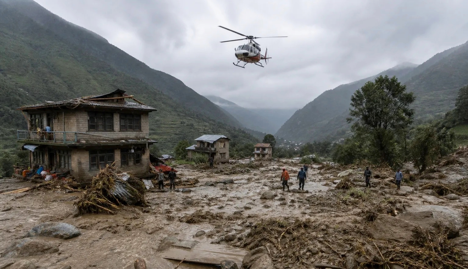
The death toll has climbed sharply as rescuers search for more than 1,400 missing people, while newly formed lakes raise fears of further flooding along the already devastated border region.
This article is an update to our August 27 report HERE.
The catastrophic flash flooding that struck the Nepal-China border on August 26 has entered a grim third day, with the confirmed death toll now approaching 400 and more than 1,400 people still reported as missing and unaccounted for across Nepal and Tibet. Rescue teams continue to search devastated valleys and river systems, but the operation is being complicated by destroyed roads and bridges, unstable slopes, continuing rain, and the possibility of another major flood.
The latest figures remain fluid, and it must be noted that there are significant discrepancies between agencies as bodies are recovered and missing-person lists are reconciled. ABC News reported Friday morning that at least 392 people had been killed, while Nepal’s Ministry of Foreign Affairs had confirmed 359 recovered bodies in its latest official update Thursday evening. China has reported three deaths in Tibet. More than 1,400 people are believed to remain unaccounted for across the two sides of the border.
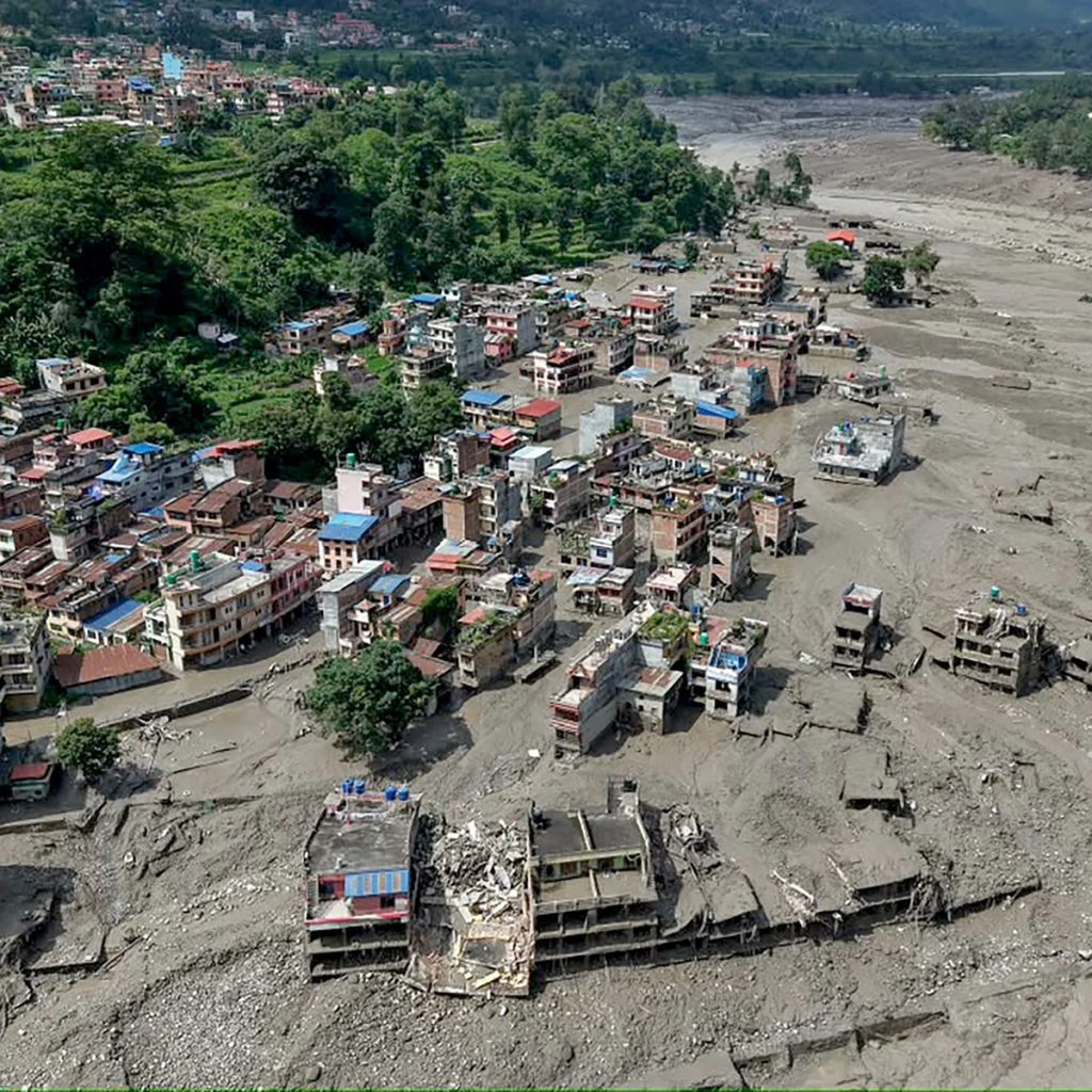
The number of missing foreign nationals, however, has become somewhat clearer. Nepal’s foreign ministry said 596 foreigners from 33 countries remained missing in its latest verified tally, including 51 Malaysians, 167 Indians, 66 Americans, 53 Ukrainians, 35 Australians, 33 Britons, and 25 Canadians. Those figures are themselves subject to verification as rescue teams reach previously inaccessible areas.
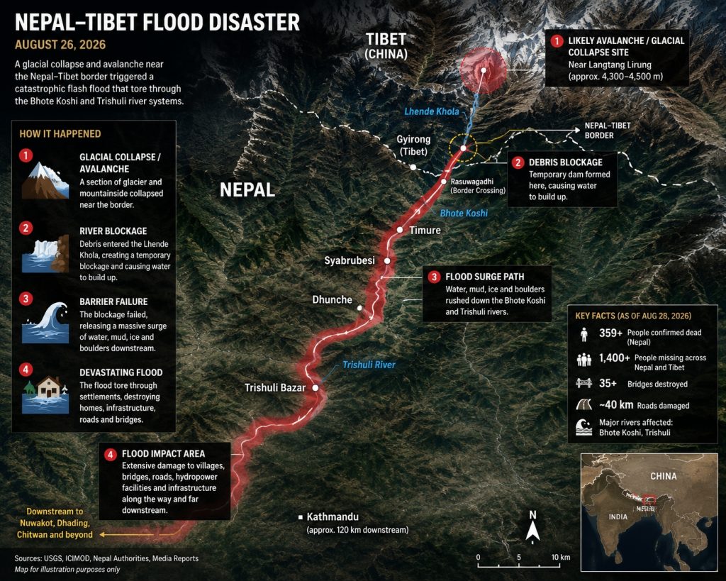
The disaster struck the Bhote Koshi river system in Rasuwa District, with the initial torrent travelling through the Lhende Khola and then into the Bhote Koshi and Trishuli rivers. Timure and Syabrubesi were among the worst-hit settlements, while the flood continued downstream into Nuwakot and Dhading. Bodies have subsequently been recovered much farther south, including in Gorkha, Tanahun, Chitwan, and the Nawalparasi districts, demonstrating the extraordinary distance and force of the flood wave.
A GLACIER AND MOUNTAINSIDE COLLAPSE
There is now considerably more evidence about what triggered the disaster than there was in the immediate aftermath. Initial seismic readings led to reports of a magnitude 4.4 earthquake, but the U.S. Geological Survey subsequently determined that the event was instead a magnitude 5.2 glacial collapse and debris flow. Satellite imagery examined by geologists indicates that a section of glacier on Langtang Lirung, near the Nepal-Tibet border, collapsed along with a much larger section of the underlying mountainside. The resulting avalanche of rock, ice, mud, and debris entered the river system with devastating force.
The scale and speed of the resulting flood were extraordinary. ICIMOD reported that water levels in the Trishuli River rose by as much as nine metres in just 30 minutes, leaving communities with little or no opportunity to evacuate. At least 35 bridges and around 40 kilometres of roads have been damaged or destroyed, while hydropower facilities and other critical infrastructure have also been badly affected.
Scientists are still examining the precise sequence of events, including the role of the glacier collapse, the mountainside failure, and existing river conditions. What is already clear is that this was a cascading high-altitude disaster rather than a conventional river flood.
FURTHER FLOODING REMAINS A SERIOUS THREAT
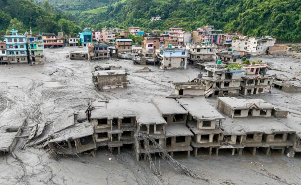
The immediate rescue operation has therefore been complicated by another potentially dangerous development. Debris from the initial collapse has blocked waterways on both sides of the border, creating new lakes whose water levels are continuing to rise.
China has warned that a newly formed lake near the border could receive approximately three million cubic metres of additional water over the following three days, with the possibility of a breach if the debris dam fails. Nepalese authorities have issued similar warnings and urged residents, travellers, and rescuers to stay away from riverbanks and other vulnerable areas. Some rescue personnel have already moved to higher ground as a precaution.
For families waiting for news of missing relatives, the uncertainty is compounded by the sheer geographical scale of the disaster. Among those unaccounted for are pilgrims and tourists travelling through the region toward Mount Kailash, as well as Nepali residents, security personnel, hydropower workers, and people travelling along one of the country’s important northern trade and transport corridors. The Nepalese government has established an emergency control room specifically to coordinate information concerning missing foreign nationals and has warned the public against circulating unverified reports.
The search is likely to remain difficult for days. Roads and bridges have disappeared, communications have been disrupted, and the terrain itself remains unstable. Helicopters and military personnel are being used where ground access is impossible, while teams continue recovering bodies far downstream from the original impact zone.
For now, the priority remains finding survivors and accounting for the missing. But the disaster has already exposed a much broader vulnerability in the Himalayan region, where unstable glaciers, steep terrain, increasingly hazardous weather patterns, and settlements built along narrow river corridors can combine to produce disasters with astonishing speed and little warning.
Sources: Nepal Ministry of Foreign Affairs; Reuters; Associated Press; ABC News Australia; U.S. Geological Survey; International Centre for Integrated Mountain Development (ICIMOD).